| 1 |
 |
“...52 POCKET GUIDE TO THE WEST INDIES
is a famous rubber tree. In the former residence is the
Museum of the Bermuda Natural History Society (open
io a.m. to 4 p.m., Sundays excepted). Here also is the
Public Library.
The north end of Burnaby Street is called Cedar
Avenue, a delightfully shady walk skirting one side of
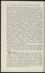
Victoria Park, an ornamental garden containing many
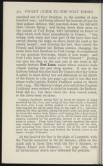
beautiful flowering shrubs and trees, a somewhat con-
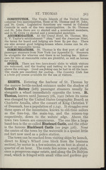
ventional bandstand erected to commemorate Queen
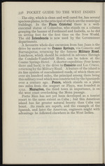
Victoria’s Jubilee, which was formally opened in 1890,
and a War Memorial to the memory of members of the
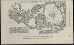
Bermuda Volunteer Rifle Corps who fell during the.
Great War, 19x4-1918.
A continuation of the road leads to St. John’s, the
parish church of Pembroke Parish. In it lie the remains
of Bishop Field and Sir Robert Laffan, Governor from
1877 to 1882, whose name survives in “ Laffan’s Plain,”
Aldershot.
Mount Langton the Governor’s residence (about 1 mile
from the wharf), is reached by way of Burnaby...”
|
|
| 2 |
 |
“... older
church, and was opened for diVine service on April 19th,
1840, the foundation-stone having been laid by Sir
Francis Cockbum, the then Governor of the Bahamas
in 1837. It is a plain building of stone. The see oi
I
r
I)
lb
r
u
I
lb
fc
C
k
|n
hi
ft
||
PJ
|e
ai
ni
B
11
h
b
il
#
it
!,oi
f
A
01
m
Ejp’
,w
[IB
jn
C(
12:
T...”
|
|
| 3 |
 |
“...122
POCKET GUIDE TO THE WEST INDIES
Lenegan, Nelson, and Pelican. High up on the mountain
side is seen the rugged Fort St. George, now used as a
signal station (see page 132), and Port of Spain spread
out on a plain at the foot of lofty mountains comes into
view. ' .)J
Port oï Spain, capital of Trinidad since 1783, occupies
the site of the old Indian village of Conquerabia. It is
justly regarded as one of the cleanest and.most sanitary
towns in the West Indies. Well laid out, its streets are
lighted by electricity, and its main thoroughfares
traversed by open electric trams. The wharves axe on
land reclaimed from the Gulf, and the Harbour Master s
office behind them occupies an old fort which in
Chacon’s time stood on a small island connected with the
mainland by a stone pier.
From the wharves—where the Customs formalities are
not tiresome—St. Vincent, Abercromby, and Chacon
Streets, and Broadway, running parallel with one another,
lead to Maxine Square, a spacious...”
|
|
| 4 |
 |
“...TRINIDAD 133
supply of materials, before he was acquitted. It was
to this fort that the merchants of Port of Spain took
their books and valuables when the English Fleet was
mistaken for that of Villeneuve, which Nelson was
pursuing, in 1805, immediately before the battle of
Trafalgar.
At one part the Diego Martin valley opens out into a
flat plain, which formerly used to be under sugar-canes,
but is now for the most part quite uncultivated. The
plain has an evil reputation, having been the scene of
no fewer than four blood-curdling murders, the last
having been when a priest was brutally murdered and
was found tied to a tree. About a mile this side of the
Blue Basin are situated the Diego Martin Waterworks,
which were formally inaugurated in 1907. The River
Estate was acquired by the Government in 1897 in
order to protect the sources of water supply. The lower
portion is now cultivated as a cocoa estate in charge of
the Department of Agriculture and is surrounded by...”
|
|
| 5 |
 |
“... the island, buttressed by numerous ridges
branching off from it, gradually sloping down to the
sea on either side, and leaving narrow fertile valleys
between them. The flattest parts of the island are at
Gros Islet, at the extreme north-west, and Vieux Fort,
at the south-east, where the backbone ceases, giving place
to a plain. The Canaries Mountain (3,140 feet), in the
centre, is the highest point, and the most mountainous
part is on the leeward side in the neighbourhood of the
Soufrière, a volcano the crater of which is about three
acres in extent. There are also other traces of volcanic
activity in the island, in the form of hot springs and
sulphur. To the south of Soufrière Bay the two conical
mountains known as the Pitons, or the Peaks, form
prominent landmarks, the grandeur of which is un-
equalled throughout the West Indies. They rise to a
considerable height, which is emphasised by their
isolation, the Gros Piton being over 2,619 feet high and
the Petit 2,461...”
|
|
| 6 |
 |
“... spite of the
small rainfall. It is recorded that in 1731 the scarcity of water
was so great that a pailful of that precious liquid was sold for
three shillings 1 Bendal’s Stream has been dammed in two
places and much rain-water which used to run out to sea is
thus conserved. The wells or springs in the central plain from
St. John’s to Willoughby Bay being brackish, the only water
available in the locality is that which is collected in ponds and
pools. Wells in the limestone region on the north-east of this
central plain yield good water, and there are also a few wells
lying to the west and south of the plain. In some parts of the
island the people are dependent on water collected in ponds,
and in times of drought they suffer considerable hardships.
St. John’s has now an excellent water-supply derived from a
reservoir at the Body Ponds, and Wallings Reservoir, a large
tank in the hills which was completed twenty-five years ago at
a cost, with its pipe service, of over...”
|
|
| 7 |
 |
“... plain, at the south-west of which is Basseterre, the
capital of the island, situated on the shore of an open
roadstead. At the south-east comer there extends a
narrow isthmus not more than a mile or a mile and a half
wide, that expands into a knob of land on which there
are salt ponds. A strait called the Narrows, scarcely
two miles in width at this point, separates St. Kitts from
Nevis. Between them is a tiny islet called Booby
Island. On the lower levels the soil of St. Kitts is
naturally rich and highly fertile. The island is well
watered, and Richard Blome’s description of it, written
in 1672, still holds good: “ The land lieth high and
mountainous in the midft from which fpringeth feveral
Rivers, which oft-times by reafon of the Raines that
falleth down the mountains, are overflown to the
detriment of the inhabitants.” During the heavy rains,
“washes” sometimes occur which do much harm to
cultivation.
INDUSTRIES. Sugar is the chief industry of St. Kitts.
Though the...”
|
|
| 8 |
 |
“...ST. CHRISTOPHER OR ST. KITTS 223
superstition that the lake is bottomless, with a dangerous
whirlpool, probably arises from the fact that the outlet
on the west, carrying the overflow to Godwin’s Gut, is
hidden and leads to a waterfall which might be disastrous
to the unwary.
The drive Round the Island is an expedition which
every visitor to St. Kitts should make. The distance is
.30 miles. By carriage the time required is from four to
five hours; but by motor-car, of course, much less.
Crossing the plain of Basseterre to the north-east of the
island, one passes the large Central Sugar Factory (1 mile),
-belonging to a company called the St. Kitts (Basseterre)
Sugar Factory, Limited, which was opened in 1912. It
is equipped with the most modem machinery and has
about 19 miles of light railway for bringing the canes to
the mill. The capacity of the factory is 15,000 tons of
sugar, and during crop time the buildings present a busy
aspect. Permission to view the factory...”
|
|
| 9 |
 |
“... (1746); and General
William A. Villettes (1808), Lieut.-Governor, by Sir
Richard Westmacott. Rear-Admiral Charles Holmes,
Commander-in-Chief, 1760-61; Christopher Lipscomb,
first Bishop of Jamaica; Lucas Barrett, geologist;
Commodore Peter Cracroft (1865); and Sir James
Fergusson, who was killed by the earthquake of 1907,
were buried in the churchyard.
In the old burial-ground at Halfway Tree lie buried
George Bennett, who “ came here a soldier under General
Venables,” and two infant sons of Governor Sir William
Beeston, who died in 1677 and 1678, and Elizabeth
Dalling.
King’s House, the official residence of the Governor,
is about four miles from Kingston in the parish of St.
Andrew, on the Liguanea Plain. Like the public
buildings it was designed by Sir Charles Nicholson and
is constructed of reinforced concrete. The building
comprises three floors, the rooms being arranged round
an open patio, and most of them opening on to broad
verandahs. The billiard- and ball...”
|
|
| 10 |
 |
“... the fort, hauled
down the republican flag, and hoisted the British union' in its
stead.—Cooper Willyams.
At the head of the Bay is the plain of Lamentin, with
the Vauclin mountain in the far distance, while on the
south side is Trois Ilets with the Ilet a Ramiers, or
Pigeon Island (not Rodney’s. See page 180), with
its fortifications which once defended the position....”
|
|
| 11 |
 |
“... waterside is a quaint little
red fort now used as a police station.
The town can be reached from visiting ships by launch,
direct to King’s Wharf (one block from the business
section), by motor in a few minutes, or on foot in about a
quarter of an hour. The route lies across a small plain,
once a prosperous sugar estate, and along the De Beltjen
road, which is fringed with small villas and gardens gay...”
|
|
| 12 |
 |
“... military road which was constructed by the Spaniards
over a century ago. Ponce, which stands on a plain
two miles from the seaport or Playa, was founded in
1752. Mayagüez, the third town in importance, is on
the west coast overlooking the Mona passage.
Porto Rico has not yet been developed as a tourist
resort to the same extent as Cuba ; but this American
island has far greater natural beauty than Cuba can
boast. Its roads are superb, and the example of the
Spanish, and later the American, engineers might with
advantage be followed elsewhere in the West Indies....”
|
|
| 13 |
 |
“...CUBA 3êi
boasts superb scenery which can be enjoyed by taking
the steamer to Rodas and back.
It is now possible to visit Eastern Cuba in great
comfort, thanks to the service provided by the Cuba
Railroad Company. Two trains leave Havana daily,
one in the early morning and the other at night, for
Santiago. In the provinces of Santa Clara, Camagiiey,
and Santiago the road runs through rolling plains and
mountainous regions. Camagiiey (population 29,616;
3-40 miles) has many old mediaeval buildings. The
climate of the city, which lies on a plain 550 feet above
sea level, is particularly good. Among the attractions
of the place are its weather-worn churches, the most
interesting being those of La Merced and La Soledad.
The former was built about the year 1628 by mis-
sionaries of Our Lady of Mercy. Its high altar is of
silver and was fashioned from 40,900 Spanish dollars.
La Soledad was a hermitage in 1697. The present
building was begun in 1758. The frescoes date from...”
|
|
| 14 |
 |
“...Hts£±AseiA
A PLAN of CARTAGENA,
7£gS®
a k e
g^gpS^I
W?lm
m
CABTACENA
Mr Papt of the Se* vat formerly a
Plain, on vhich the Inhabitants of Carta
gcna ufed to valk, but has been fir Jotne time
overflowed, and the rolling of the Sea upon ad
this Coafl, is an invincible Rampart to Car-
tagena, fo that it is only approachable by ™e
Lake.
Cartagena at the Period of Vernon’s Attack o
Reproduced from The Gentleman’s Magazine for 1740.
THE SPANISH MAIN...”
|
|
| 15 |
 |
“...West Indian
Cable Service
RAPID — RELIABLE — ACCURATE
“ via Bermuda91
Turks & Caicos
Islands—
Grand Turk
Halifax, N.S. jr*
108, Granville
Street /*/Sj
HEAD OFFICE:
33, Old Broad Street
LONDON E.C. 2
TELEPHONE : CENTRAL 2914
Telegrams should always be addressed in the following manner :
“Jones, London, “Smith, Jamaica, “Robinson, Barbados,
Via Bermuda.” Via Bermuda.” Via Bermuda.”
“ Via Bermuda ” is not charged for.
Plain language, Deferred Messages at Half Rates.
Social and Business Codes are available at all the
Companies’ Stations free of charge.
Wireless Station at KINGSTON, JAMAICA.
xxiii...”
|
|