|
|
|
Your search within this document for 'semi,siléndriko' resulted in two matching pages.
|
| 1 |
 |
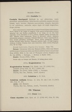
“...latera
spinarum una cum floribus propullantia, 2 cm. longa, 1,3 cm. lata, basis
augustata, nervis lateralibus 2 vel 3, coriacea. Stipulae petiolo breviores, Ses-
siles, trigonae, dense tomentosae. Flores in fasciculos collecti. Alabastra
mitraeformia perpauce acuminata. Pedicelli flliformes. Calyx expansus 0,6 cm.
latus, laciniis patentibus, acuminatis. Discus planus pentagonus. Stamina
laciniis calycinis multo breviora. Filamenta antheris duplo vel triplo longiora.
Antherae ovöideae. Ovarium disco semi immersum, stylus conicus. Drupa glo-
bosa, 0,6 cm. longa.
Bessji kabrieto, Paaloe die bessji. Plate VII.
CurasaoCalcareous hills near Malpais (4894); Hills near Siberie
(4976) (type-); Calcareous hills near Siberie (5267); Calcareous soil near
Knip (5580); Hills to the east of Westpunt (5441); Seashore near
St. Jan (5693). — Suringar, — Britton & Shafer 8056.
Bonaire: Rincon (7063, 7060).
Occurs only on Curasao and Bonaire, 15 finding places noted.
4875a. Krugiodendron Urb.
Krugiodendron ferreutn...”
|
|
| 2 |
 |
“...the same limestone terraces which exist on the West coast of
Curagao.
Bonaire.
The West point of the island lies at ± 68° 12' W. Long, and
12° 14' N. Lat., the most Southern point at ± 68° 24' W. Long,
and 12° 13' N. Lat. The greatest length of the island is 36 kilo-
metres, its surface about 240 square kilometres. It consists of
a quaternary limestone formation, pierced in two places by moun-
tainous complexes of cretaceous origin, diabase and glimmer por-
phyrite.
A limestone mountain-range of semi-circular shape separates the
Rincon plain and the part to the West of this latter from the
other non-calcareous part, which extends over a much larger
surface than Martin’s map shows.
The remaining part of the island East of this limestone complex...”
|
|
|
